Monday, August 31, 2020

Snowcover at the end of August

Snowcover in the caldera has been decreasing through August, and is now at roughly 75% by area. The image above was acquired by Sentinel-2 on the 26th. Although it now appears possible to reach Stella Point without ascending on snow, considerable snow remains in some places, such as to the east of the Northern Icefield.

During the boreal summer months of June-August, when the sun is in the northern hemisphere, less solar radiation is received on any slope inclined to the south. Note the extent of snowcover remaining on the mountain's southern slopes (above). This
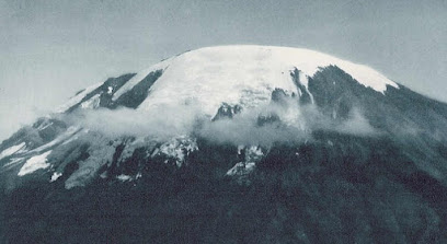
area coincides with where the Southern Icefield used to exist - illustrated below during Walter Mittelholzer's flight over the mountain in January 1930. Whereas most of the white area in 1930 is snow over glacier ice, very little ice remains on the south side in 2020.

(Preservation of seasonal snow on the south side is not solely a function of aspect. The spatial pattern of snowfall on the mountain between November 2019 and June 2020 is not known (and was likely not uniform), and snowcover retention is also governed by the s
easonal distribution and extent of cloud cover.)


Below: Mittelholzer's Fokker F.VIIb-3m "Switzerland" refueling enroute to Kilimanjaro [credit].


Wednesday, August 5, 2020

Meteorological gradients on Kersten Glacier


The latest Kilimanjaro AWS paper is out, in the EGU Open-Access journal "Earth System Dynamics". Collaborator Thomas Mölg at Friedrich-Alexander-Universität conceived the concept and led the analysis and writing* on Mesoscale atmospheric circulation controls of local meteorological elevation gradients on Kersten Glacier near Kilimanjaro summit.

Anchoring the analysis are measurements made at two automated weather station sites, shown as #3 and #4 on the photo above (taken July 2005 by co-author Nicolas Cullen). The stations span 270 m in elevation; both were installed and operated by the Univ. of Innsbruck team, who have coordinated numerous analyses and publications emphasizing AWS 3 (e.g., Mölg et al., 2009). This new ESD paper uses data from a four-year interval of overlapping measurements (2009-2013), including the 2010 El Niño event.

Besides the empirical knowledge provided by analysis of the AWS datasets, the paper links measured on-glacier gradients to a high-resolution atmospheric modeling data set (Emily Collier), while also considering the large-scale geostrophic flow high on the mountain (~500 hPa).

This study illustrates the importance of field measurements, especially in environments threatened by climate change. Data such as these will endure forever, available for creative new analytical approaches and model validation. Sadly, the Kersten Glacier is no longer intact, now with a large gap between AWS 3 and 4. To the west (left on image above) the Heim Glacier is essentially gone, as is the Decken Glacier to the east (right). Replication of these measurements will never again be possible, due to the loss of ice at high elevations on the mountain...

Here is a link to the article (open access).

*Authors:  Mölg, T., D.R. Hardy, E. Collier, E. Kropač, C. Schmid, N.J. Cullen, G. Kaser, R. Prinz, and M. Winkler

August snowcover


Very few climbers have been visiting Kibo's caldera lately due to the pandemic, but satellite imagery shows extensive snowcover - even as we reach the approximate mid-point of the 2020 dry season.

The Sentinel-2 image above was acquired on 1 August. Snowcover has thinned somewhat over the past couple months, revealing interesting textures of the relatively-flat ash within the caldera; note for example those between the Reusch Crater and Uhuru Peak. Might these lobate features be periglacial?

With bright snowcover on the glaciers, ablation has likely been minimal. This situation is similar to that of the 2018 dry season, when a 2 August image also shows nearly-complete snowcover within the caldera. In contrast, there was no snow at the summit last year at this time.

Another curious ablation feature is visible within the caldera, on the Reusch Crater's western slopes. The dark area of bare ground was not present during the snowy dry season two years ago, nor as the 2020 dry season began in June. The timelapse below starts towards the end of June, showing only this area west of Reusch Crater. Despite low resolution, the progressive growth of this spot is apparent. While it is tempting to speculate that enhanced, localized geothermal heat may be responsible, an explanation will require an examination of topography (e.g., aspect and slope) as well as the snow distribution pattern.

Lastly, trails are visible on the western slope (top image), between Shira Plateau and Lava Tower, then to Barranco Camp and continuing toward Karanga. Also visible - largely transverse to the trails - are stream channels which in recent years have been deepened and widened by debris flows. Look for a post soon with details on these.